The deployment of robotaxis has been plagued by delays, false starts, and scrapped projects. Currently, riders can only hail a robotaxi in four cities in the United States. Challenges have ranged from securing regulatory approval of custom designs to sky high R&D costs and safety concerns.
Fully autonomous vehicles require an incredible amount of data, intelligence, and processing power to operate effectively and safely. They are equipped with an array of sensors to perceive their surroundings in real-time and detailed maps to help them contextualize those surroundings in absolute terms. Complex and compute-heavy processes interpret all that data to enable the vehicle to safely move within the environment.
The challenge facing automakers is how to leverage those tools to expand the environments where robotaxis can operate and to ensure safety, all while keeping data and compute costs low enough to turn a profit.
What is in The Vehicle Localization Tech Stack?
The vehicle localization tech stack consists of several types of sensors that each serve a unique purpose:
- Perception sensors serve as the “eyes” of the vehicle and seek to mimic (and improve upon) human perception. These sensors include radar, LiDAR, and cameras, and are used to detect a vehicle’s surroundings relative to its current location.
- GNSS sensors leverage satellites to determine the vehicle’s absolute position on the earth’s surface. These sensors include a standard GNSS receiver as well as GNSS corrections to enhance accuracy, and are used to pinpoint a vehicle’s location on a map.
- Motion sensors track the movement of the vehicle itself. These sensors include wheel odometry and inertial sensors, which are used for stabilization and crash detection. As part of the localization tech stack, they fill in any brief gaps when other sensors may not be receiving data due to environmental conditions.
- Maps can be thought of as a vehicle’s memory. As the vehicle takes in data about its surroundings and its position on the earth, maps enable the vehicle to “see ahead” beyond the range of its perception sensors. Vehicles may be equipped with many types of maps, such as basic road networks, HD feature maps, and live services.
Autonomous vehicles must decide in real-time how they are going to use this vast amount of data to most efficiently, effectively, and safely operate in a given environment. Consider the difference between a dense city center and a rural road with no lane markings. The former has an abundance of physical features to react to and prior knowledge collected from millions of miles of driving, while the latter has limited physical features and a sparser history of data. The strategies the vehicle must employ in each environment are dramatically different, and the vehicle must be able to independently and immediately determine which strategy to use.
This is why all active and planned robotaxi deployments are concentrated in some of the country’s largest cities and their operating domains are narrowly defined to include only the most favorable conditions.
How Do Robotaxis Determine Their Location?
Today’s vehicles typically leverage some combination of sensors to assist with various functions such as turn-by-turn navigation, lane-keep assist, and adaptive cruise control. Robotaxis rely very heavily on perception sensors and HD maps derived from point clouds to enable full autonomy.
Point clouds are 3D renderings produced by LiDAR that capture detailed information about an environment. That data is then translated into an HD map that the vehicle uses to “recognize” its surroundings. While a robotaxi is operating inside an area covered by HD maps it can determine its location with high accuracy. But if the vehicle leaves that area, it will not have sufficient data to determine its position with a high degree of confidence.
These types of HD maps deliver an incredibly accurate way for a robotaxi to determine its location within the boundaries of the map, but they do come with several limitations:
- They’re expensive to purchase and maintain.
- They require frequent updates as road features change.
- They consume a lot of processing power.
- They’re not available everywhere.
If robotaxis are to expand their service domain into smaller cities and suburbs, they will require a localization method that is much more scalable and cost effective.
Precise Positioning Can Bring Robotaxis to More Places
Because the cost of creating and maintaining maps that support perception-based localization is so great, it only makes sense to use them in areas that are frequently traveled, where the cost can be amortized over a large number of trips. Suburban and rural areas with lighter traffic are not ideal locations for these maps because the demand for robotaxis is not sufficient to justify the costs. Additionally, these types of locations also tend to be less feature-rich and don’t offer enough physical markers to reliably and precisely pinpoint the location of a vehicle.
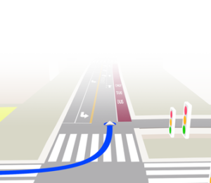
Precise positioning does not require physical features to anchor a vehicle’s location. Precise positioning combines raw GNSS sensor data with GNSS corrections to determine the vehicle’s absolute location on the earth’s surface with centimeter-level accuracy. It works with standard road network maps with centerline data to understand its position in the context of the road. Precise positioning can help a vehicle maintain its position in the center of the lane (even if the road has no lane markings), detect whether it’s on a highway or the access road a meter away, determine whether it needs to change lanes in order to make a turn, and much more. With precise positioning, a robotaxi can safely operate in a much wider variety of environments with far less investment in establishing a priori datasets.
Additionally, precise positioning provides a reference to update the map information for changes in the road network. If there are changes to the road network, speed limits, or rights-of-way, the vehicle can detect these and anchor them in absolute terms to the underlying map.
Precise Positioning Can Make Robotaxis Cost Competitive
Current robotaxi deployments are all in dense urban cities already saturated with rideshare services such as Uber and Lyft. While robotaxis offer a novelty factor that enables them to compete today, reducing the overall cost of development and operation will enable automakers to improve profit margins and reduce risk when expanding outside of niche markets. And with airports often located away from the city center, the lucrative airport fare has been a challenge for robotaxis due to the types of road that connect airports to business and residential areas.
Precise positioning offers robotaxi makers a much more affordable approach to vehicle localization. First, both standard maps and GNSS are available nearly everywhere and are already used in vehicle navigation systems for route planning, turn-by-turn directions, and traffic alerts. The addition of GNSS corrections is required to increase the accuracy of standard GNSS for autonomous driving, but this is a dramatically lower cost option than HD maps that support perception-based localization. The compute costs and complexity of this localization approach are much lower as well, since GNSS and standard maps do not require processing such large amounts of data.
Like all sensors, precise positioning has different performance characteristics in different operating environments. There will always be some environments, such as tunnels or narrow streets flanked by tall buildings, where perception-based localization is the more appropriate solution. But in areas with an open view of the sky, precise positioning can offer vehicle localization that is just as accurate as perception for a fraction of the cost. By limiting the area where vehicles use point cloud data to only the domains where it’s strictly required, robotaxi makers can significantly reduce their costs.
Expanding Level 3-5 Autonomy to Consumer Vehicles
These cost savings also extend the viability of high levels of autonomy to consumer vehicles. While complete reliance on perception-based localization creates cost pressures for robotaxis, it is entirely untenable for vehicles sold at a consumer price point.
Precise positioning offers an affordable and scalable solution that enables automakers to deploy L2+ and L3-5 technologies to a large number of vehicles operating in diverse environments. Much like robotaxis, today’s consumer vehicles leveraging the most advanced autonomous systems rely heavily on perception sensors and are restricted to areas with sufficient data to support the autonomous features. For instance, Ford’s BlueCruise is only available on less than 3% of roads in North America. That means consumers are paying a premium for autonomous features they can only use a fraction of the time.
Because standard road network maps with centerline data are available on most roads in the United States, precise positioning unlocks vast swaths of the country that are currently unsupported by today’s autonomous technologies.
To learn more about how precise positioning enables a wide variety of ADAS and autonomous use cases across diverse operating domains, talk to one of our automotive experts.


